
By Meghan Hill, Education Programs Manager
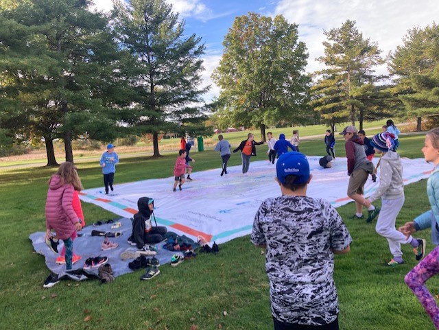
The Giant Lake Champlain Map is our truly giant vinyl map of the watershed. But how do you use the Giant Map? Great question! We’ve got five ideas to help you imagine the possibilities.
1. Teach Watershed Science
The Giant Map shows the entirety of the Lake Champlain Watershed, which extends as far south as Dorset, Vermont and as far north as Chambly, Quebec. A watershed is an area of land in which all the water eventually drains to the same place. In the Lake Champlain Watershed, water flows from many small tributaries located in Vermont, New York, and Quebec and into larger rivers and small lakes, then into Lake Champlain. Eventually, that same water flows north from Lake Champlain into the Richelieu River, then the Saint Lawrence River, and finally into the Atlantic Ocean.
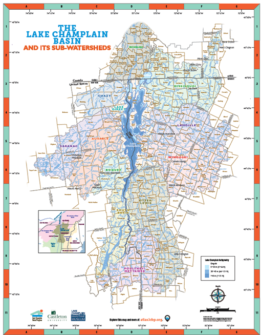
Since it depicts our watershed, the Giant Lake Champlain Map is a great way to teach students about watershed science! Often people who don’t live near Lake Champlain feel very separated from the lake and don’t realize the impact their actions have on the health of the lake. One activity we do during a watershed science lesson on the Giant Map is to have students throw an imaginary candy wrapper anywhere on the map, then trace the course that it will take following a heavy rain. Crawling on their hands and knees, students wind along the course of a small river, then a larger river, and eventually into Lake Champlain. This activity shows students how interconnected waterways are. One small action far from the lake can have a major impact on the lake itself.
2. Trace Historical Events and Maritime Routes
Tracing maritime routes on the Giant Map is a broad usage that has several great applications. This year we’re planning to show the Giant Map to students going on summer expeditions so that they can see their route up the lake in greater detail.
We can also trace historic events and routes. During their time in school, students in our area learn about the impact that our region had during the Revolutionary War. What better way to illustrate Lake Champlain’s role in the events of the Revolutionary War than to trace them on the Giant Map? When we do this with students, we start by sitting around Whitehall, NY as we talk about the construction of Benedict Arnold’s fleet. We then follow the route the boats took once they were launched and even look at how the American soldiers used their knowledge of the depth and geography of Lake Champlain to get a leg up on the British.
We can also trace other historic routes, such as the ones used by the steamboats that used to take passengers and cargo up and down Lake Champlain or the canalboats that played such a large role in the economy of 19th and early 20th century Vermont. We have even used the map to show students the locations of the wrecks of steamboats and canalboats that are part of the Lake Champlain Underwater Historic Preserves!
3. Explain Latitude and Longitude
Lake Champlain Maritime Museum has encouraged teachers to share any lesson plans they create to use with the Giant Lake Champlain Map so that we can share these lessons with other teachers in our community. One skilled teacher, Devin Schrock, developed a series of lessons focused on teaching latitude and longitude using the Giant Map.
In a time in which the world is increasingly digital, many students graduate from high school without ever having used a physical map to get somewhere. Not only can learning how to use latitude and longitude help students if they ever need to navigate or share their location using coordinates, using maps can also help them in future geography studies. The Giant Map includes lines of latitude and longitude along its sides, which means that it can be used to teach this! Additionally, learning how to find a location using latitude and longitude on such a large map means that they can walk across the map itself to explore, which helps students engage with the material.
4. Play a Game of Giant Battleship
This idea came from the 9th graders of Poultney High School. Since there are numbers long the sides of the map and letters along the top and bottom, the map is the perfect layout for a great game of battleship! This can be done in any gymnasium with a curtain that can drop down and form a barrier, so the players on each side can’t see each other. Students can stand or lay in strategic places on the map and call over to the other side with their guesses of where the opposing team’s players are. For example, if a student is standing on F3, the opposing side would have to guess F3 to get that player out.
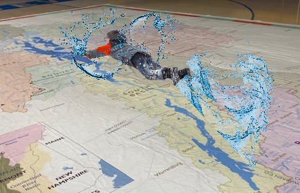
5. Use it as the Area’s Largest Slip N’ Slide
The 4th graders of Charlotte Central School came up with this idea on a warm day this fall. Since the Giant Map is made of very thick vinyl, it is just calling to be slipped and slid upon! Every time a new group of elementary school students sees the map for the first time, at least one of them tries to slide across the map on their stomach. In the heat of the summer, with a hose running cool water on the map, we could make one GIANT Slip N’ Slide. Wouldn’t you like to slide across the entire Lake Champlain watershed?
There’s no end to the possibilities the Giant Map provides! There are countless academic uses for the map, such as teaching geological change over time or using it to teach the Abenaki names for locations in the watershed. There are also innumerable ways to use the Giant Map for fun, such as laying on the warm vinyl to take a nap on a sunny day or using it to make tiny dogs feel like giants as they cross Lake Champlain in one bound. Let us know what you’d like to use the map for and schedule your visit today: Book the Giant Lake Champlain Map