By Cherilyn Gilligan, Assistant Director of Archaeology & Research
Welcome back, archaeology fans. It’s time for another update on our Arnold’s Bay Research Project.
This week we were busy delineating testing areas and preparing for a great group, the Advanced Metal Detecting for the Archaeologist (AMDA), to run a metal detecting course on the land surrounding Arnold’s Bay. The goal is to gather sample areas across what are now grazing fields for sheep and cows, as well as the transitional zones between the underwater survey and the actual shoreline, wherever it may lie at any given time (including historically) throughout the year. This will ensure we have better survey coverage across the entire site, and will give us an idea on where greatest concentrations of material culture dating to the events on the 1776 battlefield lie across the landscape. One major logistical feat includes mowing fields to allow for metal detecting (with the help of the livestock and a brushhog later on). The landowners have been generous to welcome this project on their property and have been a great help in our planning efforts to get the space prepared for a class.


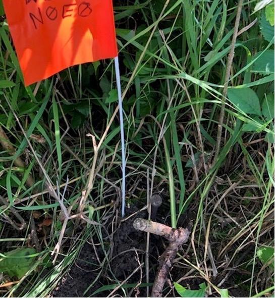
In addition to outlining testing areas, we also managed to tie the original 1988 excavation grid into our GPS map of the site through the re-discovery of the original grid markers that were left in place! With the help of preliminary metal detection around the Ferris Homestead foundation, Craig Allen discovered in-situ nails complete with the original field school string and survey tape that marked the test units from the original excavations.
Finding a few of these pins in-situ allowed us to extrapolate from those points and find more pins – some of which retained their 1988 designations written in permanent marker! While this was extremely helpful in allowing us re-orient ourselves to the 1988 excavation maps, it is shocking to see the staying power of plastic and permanent markers over 33 years in the field – we weren’t sure they were original until we saw the grid numbers! Our extrapolation work involved laying out tapes north to south and east to west and detecting every five meters along the grid to locate pins. Below you can see our newly re-discovered N0E0 marker!
More to come next week as we begin our underwater investigations of the site.