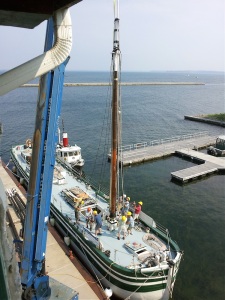
At Cape Vincent, at the upper end of the St. Lawrence River, on August 22nd, we converted the Lois McClure from a “standard canal boat,” one that has no propulsion of its own, to a sailing canal boat. With the help of a crane truck (courtesy of Rick Evans and Evans Crane) on the dock, we lifted the six spars of her schooner rig ashore: two masts, two booms, and two gaffs. Next went the braces that had kept the big sticks up off the deck. Then we stepped the foremast and set up its stays and shrouds to keep it upright. Ditto the mainmast. Now, the crane lifted First Mate Tom Larsen aloft in a basket to secure the springstay, the wire that runs between the two mastheads. Booms and gaffs were lifted back on board and put in position, held by their jaws, topping lifts, halyards, sheets, and lazyjacks. There. We were ready to bend sail.
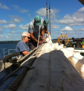
Bending sail on the schooner is always satisfying. The mainsail and foresail are four sided sails. First the foot of the sail is stretched out along the boom and hauled taut by the outhaul. The sail is lashed to the boom with many robands. Next, the head is similarly secured to the gaff. Then each masthoop is lashed to the luff of the sail. The masthoops run up the mast when the sail is hoisted to hold its leading edge to the mast. Ahh. We were ready to set sail.
All these tasks were completed safely and smoothly by Team Kerry (Batdorf, Ship’s Carpenter): Tom Larsen, Art Cohn, Jeff Gorss, Don Dewees, Jean Belisle, and Leo Straight. Kent Strobel and Bill Balling kept the interested onlookers out of harm’s way and explained to them what was happening. Kathleen Carney, Barbara Bartley, and Chris McClain kept the cold drinks and sandwiches coming.
But will we be able to set sail? We have traveled the St. Lawrence River in previous years for a dozen days without making sail. It is always difficult to sail and still maintain our schedule of port visits. We have managed it at times on Lake Champlain, the Hudson River, and the Finger Lakes, but the St. Lawrence has been particularly perverse in presenting head winds or calms, combined with contrary current when heading upstream. Well, we will hope for the best this year.
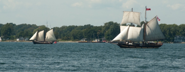
At least, now that our rig was up, we could participate in a “Tall Ships” festival at Cape Vincent. We were joined by the steel brigantine St. Lawrence II, a sail-training vessel, and the Essex (sharp-bow) pinky schooner La Revenante, both based in Kingston, Ontario. The promoters of such events stretch the truth a mite when they claim that such ships as these three are “tall.” When John Masefield, the British Poet Laureate, coined the expression “tall ship” in his poem “Sea Fever,” he wasn’t thinking of a canal schooner, or a pinky schooner, or even of a small brigantine, but rather of a big, square-rigged ocean freighter with masts three or four times as tall as ours. Never mind; it worked. On August 23rd, 24th, and 25th, more than a thousand tall-ship enthusiasts came on board to gaze up at our 65-foot mainmast.
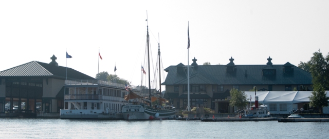
We made the three-hour tow downstream to Clayton late in the day on the 25th. We squeezed into a good berth at the Antique Boat Museum, peeling off the Churchill from the schooner’s hip into her own spot in an adjacent slip so that the schooner would fit in alongside the dock. We “boat people” were in for a lot of treats at the Museum.
First of all, many of our 300 visitors would be boat people, with an unusually high level of interest and background for a great appreciation of the unique vessel that is the Lois McClure. And, thanks to the generosity of the Museum staff, our crew would gain an appreciation of the complex waterways among the Thousand Islands and of the region’s own unique boat-type, the St. Lawrence River skiff.
The Antique Boat Museum has an impressive array of speedboats. There are both old and more recent holders of speed records, as well as boats branded Chris Craft or Gar Wood, for example, famous names in motor boating. Several of these little vessels are in the Museum’s livery fleet; they are in commission and take visitors out to explore the Thousand Islands with quick bursts of speed between islands of particular interest. Six of us in the crew started the morning of August 28th with such a ride.
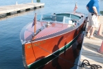
Captain Pat Sheldon brought the Miss Thousand Islands II, a reproduction Hackercraft, out of the Museum’s big, covered boathouse and over to a nearby dock, her twin exhausts rumbling to promise plenty of power.
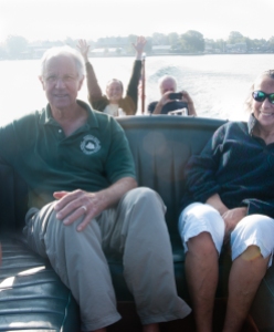
Yes, there was power to spare, for, as we left the harbor, Pat needed only about half throttle to bring the varnished mahogany beauty up to 30+ knots. Pat suddenly went vague when asked about the top speed of the boat. But on our 45-minute tour, he related plenty of details about a number of the Thousand Islands. He told us that the actual number is 1,855 and that to qualify as an island, a rocky outcrop has to stay above normal high water and have a minimum of two trees. As we passed one that barely qualified, though it did have a small house on it, Pat said that in many years of passing it, he had only seen people there twice. We were amazed that so many tiny islets had cottages. And we marveled at the smooth, fast ride that the Hackercraft delivered, a real thrill for us boat people.
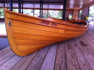
But the special boat in the Thousand Islands is the St. Lawrence River skiff. She is a guideboat, that is a boat designed specifically for the use of a professional fishing guide to take out a “sport,” to try his luck with, say, muskalunge. The skiff is a long, narrow, lightly-built, usually lapstrake-planked double-ender of breathtaking beauty, a piece of exquisite sculpture. Because the guide must be able to drop his oars in a hurry to help land the fish, the oars are worked on a vertical pin that doesn’t allow feathering, but does prevent the oars from getting adrift. Sometimes, these skiffs are raced under sail; steering is by shifting one’s weight fore and aft, no rudder allowed! I got to play guide in one of the Museum’s skiffs, taking Kathleen out to explore French Creek, at the head of the harbor. Despite the non-feathering oars, rowing the St. Lawrence River skiff was a great pleasure.

On August 29th, we crossed the River to Canada, entering at Gananoque, Ontario. The 15-mile trip took us back up the River in the main ship channel and then through the Wolfe Island Cut and across to the narrow, crooked channel that starts between Aubrey and Mermaid Islands. There is not much straight-line navigation among the Thousand Islands.
Out in the ship channel, we met the big, Great Lakes freighter Algo Lake coming down. She and the Lois McClure were expecting each other, because every sizable vessel in the St. Lawrence Seaway reports its movements to a traffic control center, which then warns each vessel of coming ships. The traffic controller has the authority to request a captain to slow his vessel in order to avoid meeting another in a narrow part of the channel.
There are not many natural harbors on the St. Lawrence. The marina at Gananoque is protected by a breakwater that makes a quiet cove alongside a point of land. We eased in behind the breakwater and moored to a long dock to receive, next day, nearly 400 Canadian citizens.
In discussions of the 200th anniversary of the War of 1812 with our neighbors across the border, we sometimes have to agree to disagree about who “won.” There were victories and defeats on both sides. The Canadians defended their country from invasion and the Americans let it be known that their new country was to be taken seriously.
On August 31st, we went back through the Wolfe Island Cut and then downstream past Clayton and through the American Narrows to Alexandria Bay. When I had scanned the charts of the St. Lawrence River, the upper part of which was new to me, I had certainly noticed the American Narrows. This is the name given to a six-mile-long, straight cut between the New York shore and Wellesley Island. I could visualize most of the water in the mighty river being funneled though the American Narrows on its way to the sea. Many of the locals we had consulted about river currents had warned us about the American Narrows. Well, we were pleasantly surprised to find no more than 2 knots shooting us along through, certainly significant, but not dangerous.
The town of Alexandria Bay boasts two natural harbors, the Upper Bay and the Lower Bay. And right across the River is Heart Island, with the famous Boldt Castle crowning it. We tied up across the end of the long, town dock in the Upper Bay on the last day of August. It was Saturday of Labor Day Weekend; the place was a miniature version of New York Harbor at the commuter hour; boats of all shapes and sizes were speeding all over, kicking up wakes that kept the schooner, tug, and inflatable surging, rolling, and bucking. On the dock, it was standing room only. Next day, more than 500 holiday-makers came on board to mix history into their celebrations.
For those of us in the crew who visited Boldt Castle, the highpoint was the Yacht House. When I first heard that there was a yacht house, I thought the name was a bit pretentious. Wouldn’t boathouse do?
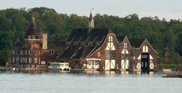
It wouldn’t. The gorgeous, shingled structure was 160 feet long and 115 feet wide. It stood 65 feet tall. There were three huge doors opening slips to the water. If we had taken down the short “topmasts” on the schooner, we could have slid the Lois McClure right inside with her rig up.
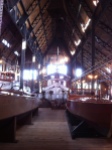
Nobody knows how many boats Mr. Boldt owned in his lifetime, but, when it ended, he had forty-seven. A good representation of his fleet is in the Yacht House, headed by a pair of big power yachts designed by George Lawley of Boston and J. Murray Watts of Philadelphia, names to reckon with in the field of yacht design a hundred years ago.
According to my log, we delayed getting underway from Alexandria Bay for the run to Prescott on September 2nd until 10:20 a.m. This was on the instruction of Seaway Traffic Control so that we would not meet the tug Victorious, pushing a big barge, in the Brockville Narrows. We met her at 1235 p.m. where there was plenty of room in the ship channel, then entered Brockville Narrows at 1:15 p.m. The channel was narrow, with about 2 knots of current; we were grateful not to have to share the place with more than the occasional, small powerboat.

The marina at Prescott is formed by two breakwaters with a narrow, curving entrance between them. Since we wanted a berth with protection from the sizable waves that big freighters pull up as they pass by in the ship channel, we went inside the breakwaters and tied up at a long, unoccupied floating dock. I was concentrating on accomplishing the maneuver without hitting anything, and so was only vaguely aware that sundry citizens were vociferous in their objections to our entry in the apparent belief that an 88-foot canal boat with a tug on her hip simply wouldn’t fit. We did, but it was soon explained to us that we were expected to moor outside on a wall. Now, we demonstrated to the skeptics that we could not only fit in, but also that we could fit back out. It was close, but, fortunately, we made it. And got secured in our assigned berth on the outside wall just in time to witness a fierce thunder squall that briefly reduced visibility to near zero. That was lucky.
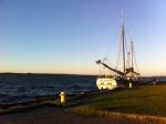
One ship wake convinced us to send the C. L. Churchill back into the security of the marina. And the people of Prescott who came on board next day had the rare experience of feeling the vessel actually roll a little after a ship went by.
We were officially welcomed by the mayor, his wife, and five, armed re-enactors, militiamen from the War of 1812. We often read in the history books about how ragtag were some of the militiamen. This group was out to prove it. Some deliberately faced left when others faced right. The suggestion to shoulder arms produced panic. But there was nothing ragtag about the fruit-filled watermelon ship that was presented to us by Raymond Martin, a retired Canadian Coast Guard cook. The fruit is now long gone, but we still have the vessel’s mast and sails as a memento of our call at Prescott.
The run downstream from Prescott to Salaberry de Valleyfield on September 5th was long enough, even with the push of the river current, so that we decided to break it with an overnight stop. There was no convenient dockage, so we would anchor for the night. Looking at the chart, I found, at about the halfway point, a cove at the mouth of the Raquette River that seemed indented enough to get us out of the St. Lawrence flow.

On the way down, we went through three of the huge Seaway locks. The first one we came to, the Iroquois Lock, has no drop, unless the river is in spate; it’s really more like a guard gate to control the current in the ship channel if necessary. So, we went in, the upstream gates shut behind us, and then the downstream gates opened, and we went right through without tying up. We got word that the Jan S, a big freighter, was coming up through the Eisenhower Lock, so we waited for her to go by, drifting, well out of the channel, under the lee of Croil Island. Then we went on down through the Eisenhower and Snell Locks. The Lois McClure seemed very small, as she was let down in their caverns.
At our cove at the Raquette River, the new anchor that we had acquired from the Schenectady Yacht Club bounced along on stones, instead of settling into the mud indicated on the chart for the type of bottom. We were out of the worst of the current, but there was enough so that when the anchor did catch hold the schooner pulled hard on its heavy chain and nearly straightened out its catenary. Because of the rocky bottom, we laid out a second anchor, the big Danforth from its new place on board the Churchill.
We had crossed the U. S.-Canandian border several times coming down the St. Lawrence River. The Raquette River runs through the Mohawk territory of the Akwasasne. After dark, we were visited by one of their patrol boats, and, not to be outdone, the U. S. Border Patrol also came by to check us out. All passports were in order.
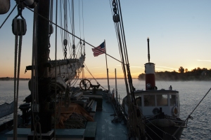
Next morning, when we weighed anchor, our new starboard bower came up well bent. Mercy. When it caught and held the schooner with a fluke under a rock, the strain was enough to bend both shank and fluke. It now has such a crazy look to it that we dubbed it the Salvadore Dali anchor. Despite its appearance, it’s still serviceable, one of the best anchors in our collection.
By afternoon, we were moored at Salaberry de Valleyfield, Quebec, having traveled the length of Baie St. Francois. The Quebecois have plenty of provincial pride; we were careful to hoist our Quebec courtesy flag to the head of the schooner’s foremast.
Roger Taylor
Captain
